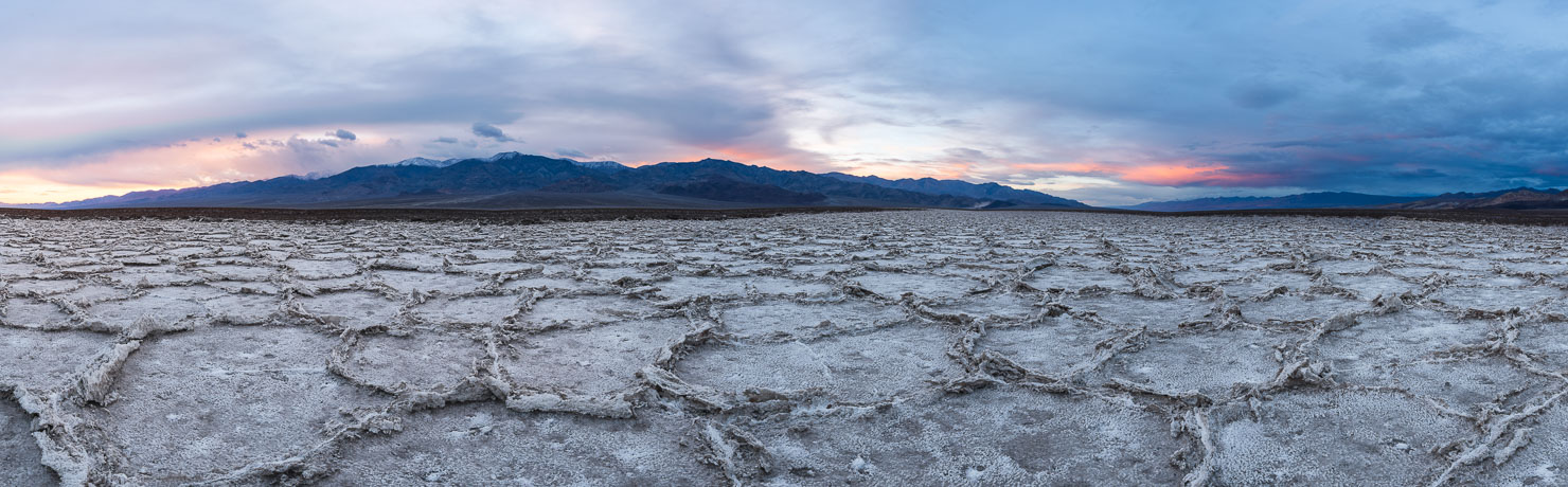
Death Valley National Park is one of my all-time favorite places on Earth — and I say that having photographed across five continents. What keeps pulling me back isn’t just the scale of the place, though that alone is staggering. It’s the fact that Death Valley is never the same twice. The sand dunes are constantly being resculpted by wind. The salt patterns at Badwater Basin shift with every rain cycle. The Racetrack Playa changes slowly, mysteriously, in ways scientists still debate. Every visit feels like scouting a new location.
Death Valley sits on over 3,000 square miles of terrain and holds the records for lowest elevation, highest recorded air temperature, and driest conditions in North America. Badwater Basin sits at 282 feet below sea level. Summer temperatures routinely exceed 120°F. I’m not telling you this to scare you off — I’m telling you because going prepared is the difference between a transcendent experience and a dangerous one. Plan well and this park will reward you like nowhere else.
About Death Valley
Death Valley National Park straddles the California-Nevada border in the northern Mojave Desert. Despite its reputation as a barren wasteland, the park contains extraordinary variety: snow-capped peaks above 11,000 feet, volcanic craters, shifting sand dunes, painted badlands, and the largest salt flat in North America. For photographers, that variety means every type of light and landscape condition is possible within a single trip.
The best months to visit are November through March. Winter brings the highest chance of rain, which can produce spectacular conditions in the park — flooded playas, running washes, and occasionally a superbloom of wildflowers if rainfall has been generous. Early March is historically the best window for wildflowers. Summer is not impossible if you’re disciplined about shooting at dawn and dusk and staying in air conditioning during the brutal midday hours, but it demands respect.
Getting There
Nearest airport: Las Vegas Harry Reid International (LAS) is approximately two hours from the main Furnace Creek area of the park. It’s the most practical gateway, with the widest flight options and the best rental car availability.
Where to stay: I strongly recommend staying inside the park. Yes, you can save money at a motel in Beatty, Nevada, but you’ll add an hour of driving each way, and in Death Valley that time cost is enormous — especially when you’re trying to hit sunrise light. Inside the park, your two main options are Furnace Creek and Stovepipe Wells. The Inn at Death Valley is a beautiful historic property, but it runs $400–600+ per night. The Ranch at Death Valley is the budget-friendly alternative at the same location, typically $150–250/night. Stovepipe Wells Village Hotel is my personal preference — the rooms are comfortable, the bar and restaurant are surprisingly good, the staff is excellent, and it puts you steps from the Mesquite Flat Sand Dunes.
1. Mesquite Flat Sand Dunes
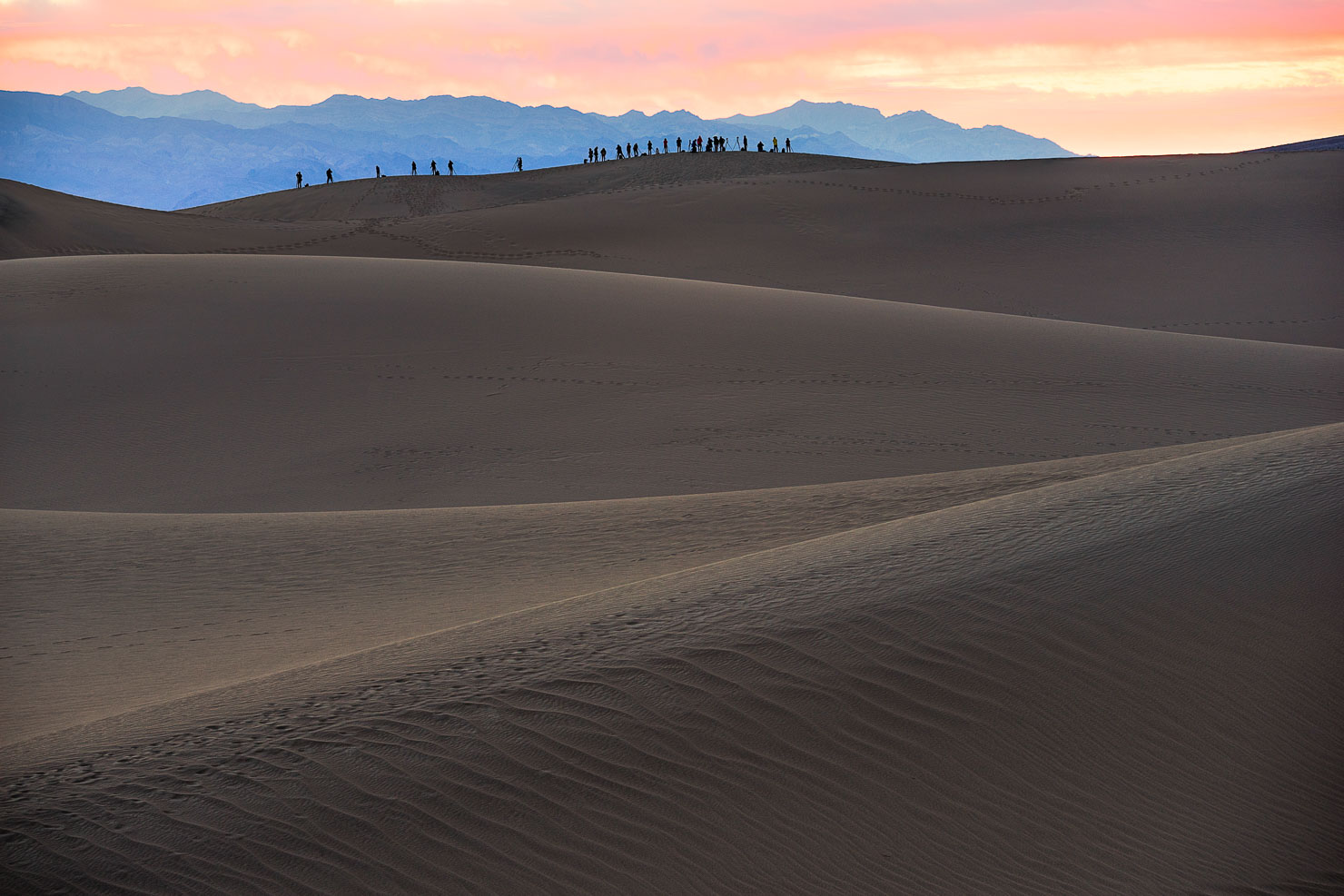
The Mesquite Flat Sand Dunes near Stovepipe Wells are the most accessible dunes in the park and, photographically, among the most rewarding desert locations I’ve ever shot. The interplay of light and shadow across the curved ridgelines during golden hour is extraordinary — and it changes by the minute.
The biggest challenge here isn’t finding the dunes, it’s finding pristine sand. The Mesquite Flat Dunes are heavily visited, and human footprints can be everywhere by mid-morning. Your best strategy is to be there at first light and walk deep — at least a mile into the dunes — before you start shooting. If winds were strong overnight, you may find sections of perfectly clean sand. At sunrise you’ll also get warm raking light hitting the dune faces from a low angle, which emphasizes every ripple and ridge.
Sunset is equally beautiful and offers a slightly different advantage: you can see the light in all directions, including back toward the Panamint Mountains. If you stay into blue hour and beyond, bring a GPS — the dunes all look identical in the dark and it’s genuinely easy to get disoriented.
- 🥾 Hiking difficulty: Easy to strenuous (depending on how far in you walk)
- 📅 Best time of year: Year-round
- 🌅 Best time of day: Sunrise or sunset
- 📷 Lens: Any focal length works; telephoto compresses the dune ridges beautifully
2. Badwater Basin
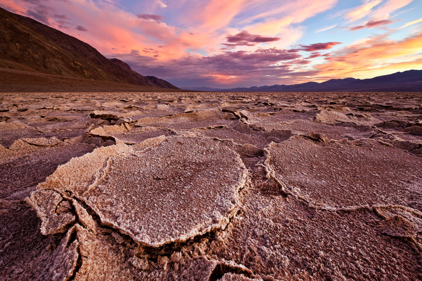
Badwater Basin is the beating heart of Death Valley photography for me. I’ve been there more times than I can count and I have never come away without something worth keeping. The challenge — and the reward — is that the patterns are always different. Scouting is not optional here. It’s essential.
What you’re looking for are the salt polygon formations on the basin floor. They’re caused by the expansion and contraction of the salt crust as the underground brine rises and falls with temperature and moisture. When conditions are right, the edges of the polygons are sharp, low to the ground, and well-defined — perfect for a wide-angle composition from ground level. When too much time has passed since the last rain cycle, the edges start to crumble and raise, which makes finding a clean composition harder. It doesn’t mean you can’t get a great shot — you just have to work harder.
After heavy winter rain, standing water can completely cover the basin floor and wipe the slate clean. Give it a few weeks and the patterns start forming again. This is actually one of the most spectacular conditions to photograph — the water creates perfect mirror reflections of the sky and surrounding mountains, and if you hit it right after a storm with dramatic clouds, you have one of the great landscape photography opportunities on the continent.
Bring a wide-angle lens and get low — as low as you can physically get. A ball head that allows near-ground-level positioning is extremely useful here.
- 🥾 Hiking difficulty: Easy to strenuous (depending on how far out you walk)
- 📅 Best time of year: Year-round; winter rain events create exceptional conditions
- 🌅 Best time of day: Sunrise or sunset
- 📷 Lens: Wide angle — get as low to the ground as possible
3. Zabriskie Point
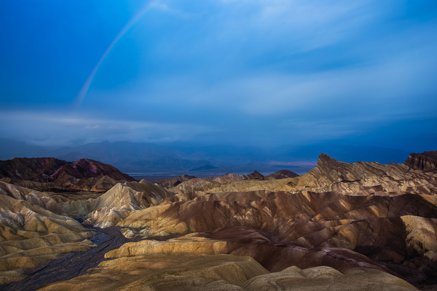
If you photograph only one overlook in Death Valley, make it Zabriskie Point. I’m generally skeptical of pull-off overlooks — they tend to produce identical images that feel passive. Zabriskie Point is the exception. The eroded badlands below, carved from ancient lake deposits into ridges and gullies of gold, tan, and rust, are genuinely extraordinary. Under the right light they look like the surface of another planet.
The viewpoint is easy to reach — there’s a parking lot and a short, well-maintained path to the overlook. Sunrise is the classic time to shoot here, and for good reason: the low eastern light hits the badlands from the side, revealing every fold and shadow in the terrain. Arrive well before dawn to get set up, because other photographers will be there.
One move worth making: don’t just shoot from the main overlook. Walk the ridge in both directions to find slightly different angles and foreground elements. And if you have time, hike down into the badlands themselves during the middle of the day (when the light isn’t great for photography anyway) to understand the terrain so you can make smarter compositional decisions at sunrise.
- 🥾 Hiking difficulty: Easy (main overlook); moderate if you hike into the badlands
- 📅 Best time of year: Year-round
- 🌅 Best time of day: Sunrise
- 📷 Lens: Any; wide angle to telephoto all produce compelling results
4. West Side Road
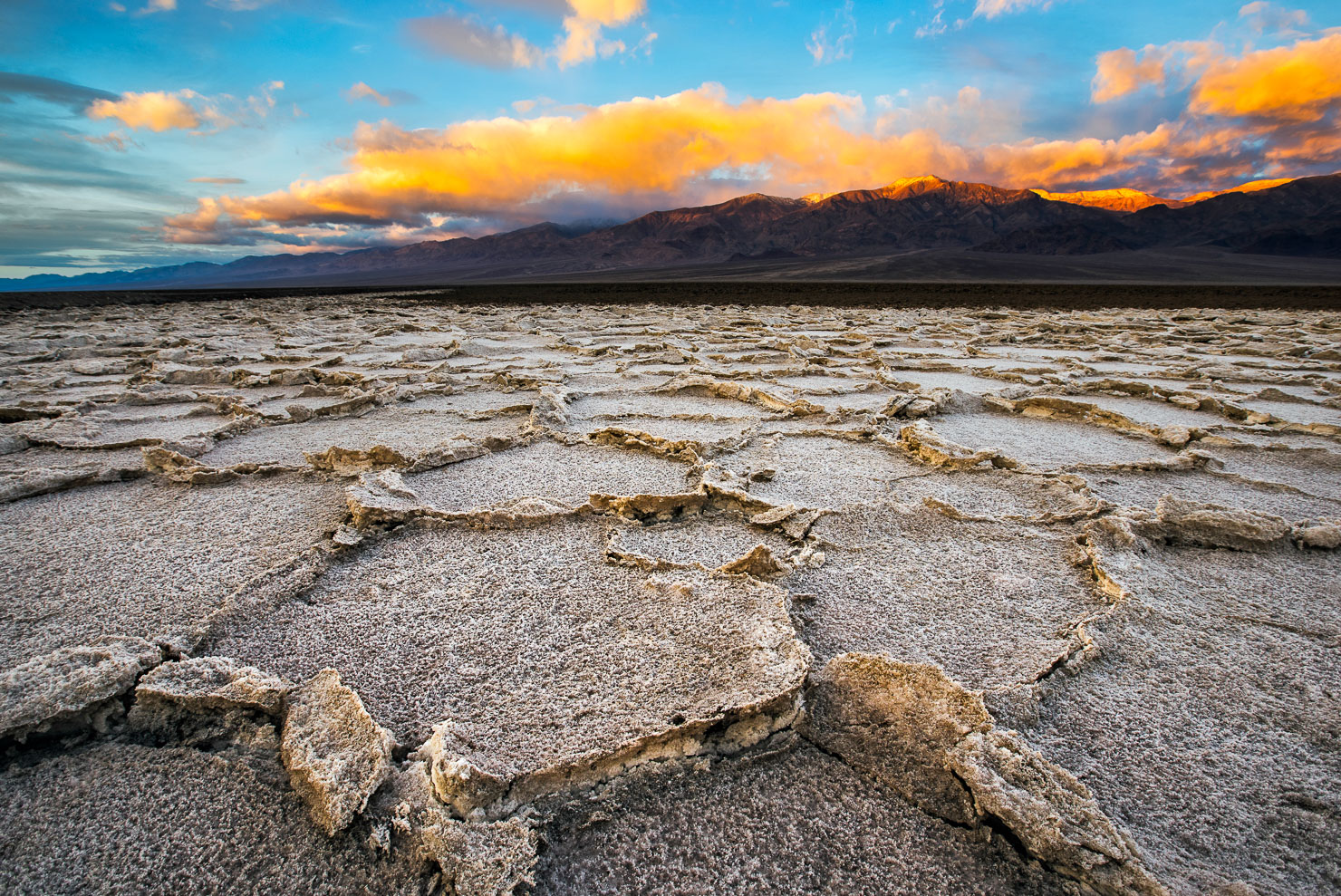
When the salt patterns at the main Badwater Basin parking area aren’t cooperating, West Side Road is your Plan B — and it almost always delivers. West Side Road is a graded dirt road that runs along the west side of the basin between Badwater and Furnace Creek. About a mile after you turn onto it from Badwater Road, you’ll find a series of salt-encrusted tributaries on the left side of the road. Pull over and walk up to them.
These tributaries run across dark, coffee-brown desert floor, which creates a stunning contrast with the bright white salt crystals. The patterns here tend to be more intimate and detailed than the main basin, and because fewer people know about them, you’re far more likely to have the place to yourself. A wide-angle lens down at ground level is the move here, same as at Badwater — the geometry and texture of the salt edges are what you’re after.
- 🥾 Hiking difficulty: Easy
- 📅 Best time of year: Year-round
- 🌅 Best time of day: Sunrise or sunset
- 📷 Lens: Wide angle — get down low
5. Artist’s Palette
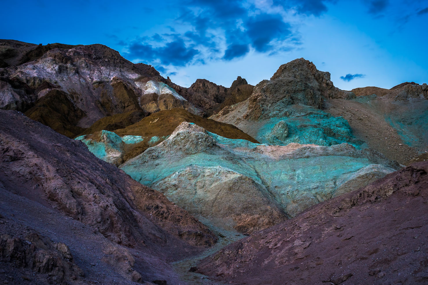
Artist’s Drive is a one-way scenic road off Badwater Road near Furnace Creek, and its main destination — Artist’s Palette — is one of the most visually distinctive spots in the park. The face of the Black Mountains here is streaked with an improbable range of colors: greens, purples, pinks, yellows, and reds, all caused by the oxidation of different minerals in the volcanic rock.
During the middle of the day the colors look muted and flat. At golden hour, and especially in the minutes after sunset during twilight, they come alive. The pinks and purples in the sky seem to amplify the colors in the rock, and the whole hillside glows in a way that looks almost surreal in photographs. Shoot from the parking area overlook but also explore on foot — you can walk into the canyon and find compositions that no one shooting from the road will get.
- 🥾 Hiking difficulty: Easy
- 📅 Best time of year: Year-round
- 🌅 Best time of day: Twilight (before sunrise or after sunset)
- 📷 Lens: Any
6. Cottonball Basin
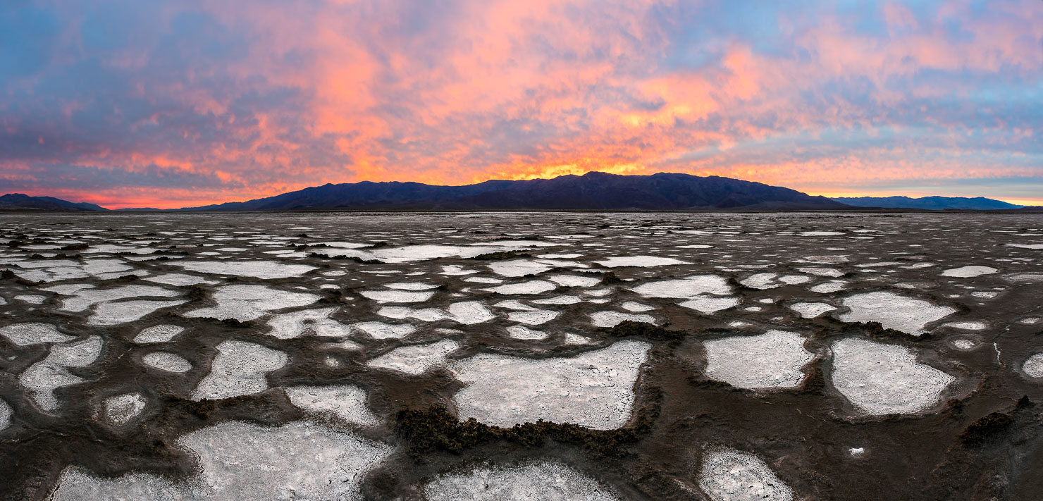
Cottonball Basin sits in the northern end of the Badwater Basin salt flat system and is one of the most underrated photography locations in all of Death Valley. Most visitors head straight to the main Badwater parking area and never make it up here, which means Cottonball Basin offers something increasingly rare in Death Valley — solitude. On the mornings I’ve shot here, I’ve had the entire basin to myself.
The salt formations at Cottonball Basin tend to be rougher and more crystalline than the polished polygons at Badwater, which gives the landscape a completely different character. The white crystals pile up into uneven, almost foam-like mounds that catch sidelight beautifully at sunrise. The basin also has a slightly different color palette depending on conditions — when moisture is present, the salt takes on a blue-gray tint that contrasts dramatically with the warm desert sky.
To reach it, drive north from the main Badwater turnoff along Badwater Road. The basin is on the left side of the road. There’s no formal parking area, so pull off where it’s safe and walk in.
- 🥾 Hiking difficulty: Easy
- 📅 Best time of year: Year-round; winter and early spring offer the most dramatic conditions
- 🌅 Best time of day: Sunrise
- 📷 Lens: Wide angle — get down low to emphasize the texture of the salt crystals
7. Racetrack Playa
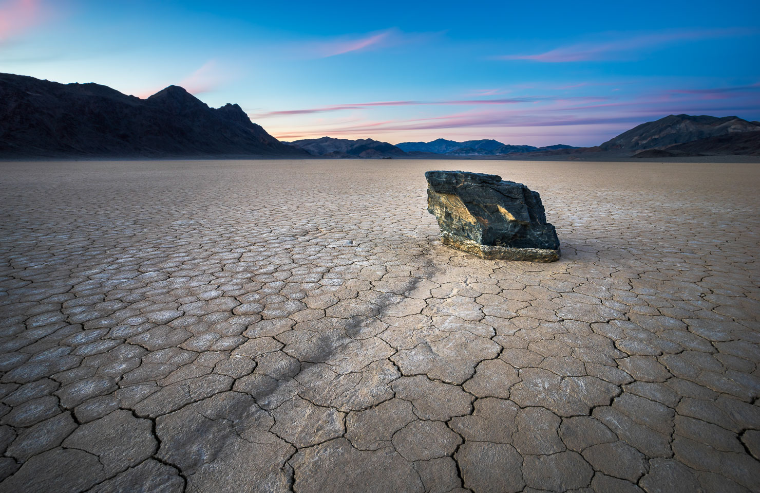
No location in Death Valley carries more mystique than Racetrack Playa — a remote, nearly perfectly flat dry lake bed at 3,700 feet elevation, famous for the “sailing stones” that leave tracks across the playa surface. For decades the mechanism was debated. We now know it involves a thin layer of ice forming overnight, which allows wind to push rocks — some weighing hundreds of pounds — slowly across the near-frictionless wet clay. I’ve stood next to a rock with a 200-foot trail behind it, and it’s one of the more surreal things I’ve experienced as a photographer.
Getting there is an adventure in itself, and I want to be honest about what’s involved. You’ll drive about an hour from Furnace Creek to Ubehebe Crater, then take the 27-mile Racetrack Road — a single-lane, brutally rough washboard surface that chews up tires and demands a capable vehicle. I’ve driven it four times. The first two times resulted in tire damage and worse. The last two times I rented a 4×4 Jeep from Farabee Rentals & Tours in Furnace Creek and the difference was completely transformative. The Jeeps come equipped with an emergency beacon, thick all-terrain tires, and the ground clearance to handle the rocks in the road. Do not attempt this in a standard rental SUV. A tow truck to Racetrack Road will cost you over $2,000.
I’ll also say this plainly: the playa has been mistreated by visitors. People move stones, stand on them for selfies, chip up the surrounding clay, and take rocks as souvenirs. If you make this trip — and it’s worth making — please leave every single thing exactly as you found it.
- 🥾 Hiking difficulty: Easy to moderate (flat playa, significant walking involved)
- 📅 Best time of year: Year-round; avoid if rain is forecast (wet playa is closed to foot traffic)
- 🌅 Best time of day: Sunrise or sunset; excellent for night photography
- 📷 Lens: Wide angle
8. Rhyolite Ghost Town
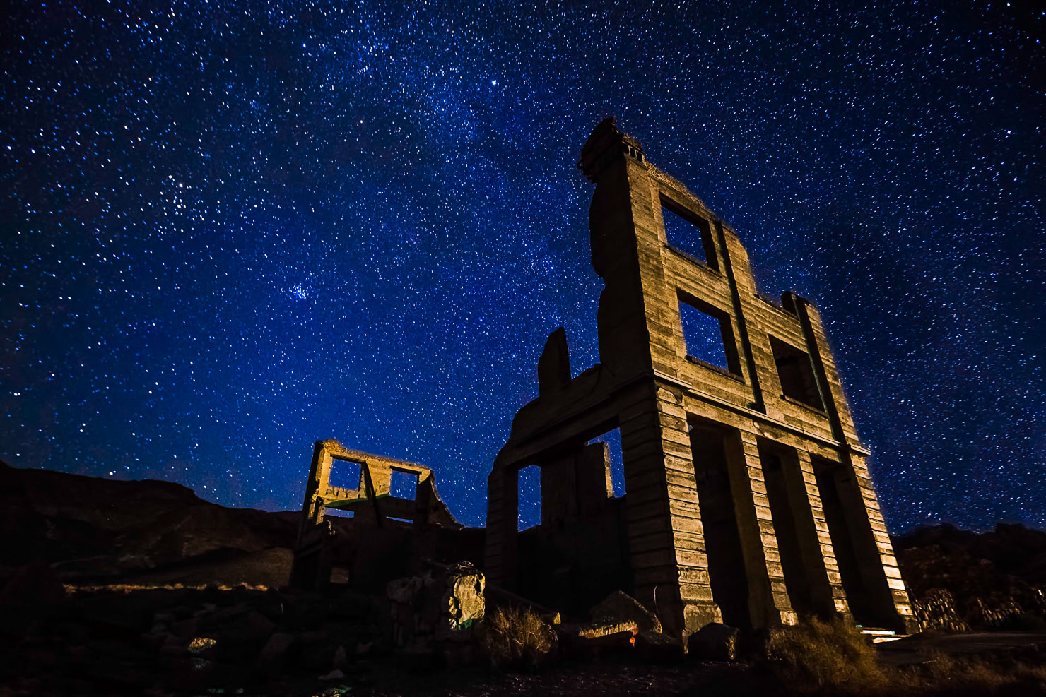
Technically just outside the park boundary near Beatty, Nevada, Rhyolite deserves a spot on any Death Valley photography itinerary. This former gold rush boomtown peaked at around 10,000 residents in the early 1900s, collapsed almost as fast as it rose, and was essentially abandoned by 1920. What remains are the skeletal ruins of banks, homes, and commercial buildings — plus a collection of genuinely strange outdoor art installations on the edge of town, including a life-size sculpture garden that is deeply eerie at night.
Scout during the day to plan your compositions, then come back at sunset or after dark. The ruins photograph well under the Milky Way, and the combination of crumbling architecture and desert sky is unlike anything else in the region.
- 🥾 Hiking difficulty: Easy
- 📅 Best time of year: Year-round
- 🌅 Best time of day: Sunset and night
- 📷 Lens: Any; wide angle for the Milky Way
Final Thoughts
I’ve been to Death Valley around seven or eight times now, and my list of places I still want to photograph is longer than the list of places I’ve been. That’s the thing about this park — its scale is genuinely humbling. Come prepared, respect the environment, plan your timing around golden hour and blue hour, and scout before you shoot. Death Valley will not disappoint.
If you have questions about any of these locations or want to know more about specific conditions at any time of year, drop them in the comments below.